Research Interest
Climate Change & Resilience;
Urban Environmental Modeling;
Climate and Health;
Social Jutice;
Remote Sensing; Geospatila Analytics
GIScience; Mahchine Learning
WRF-UCM; Predictive Modeling
Background
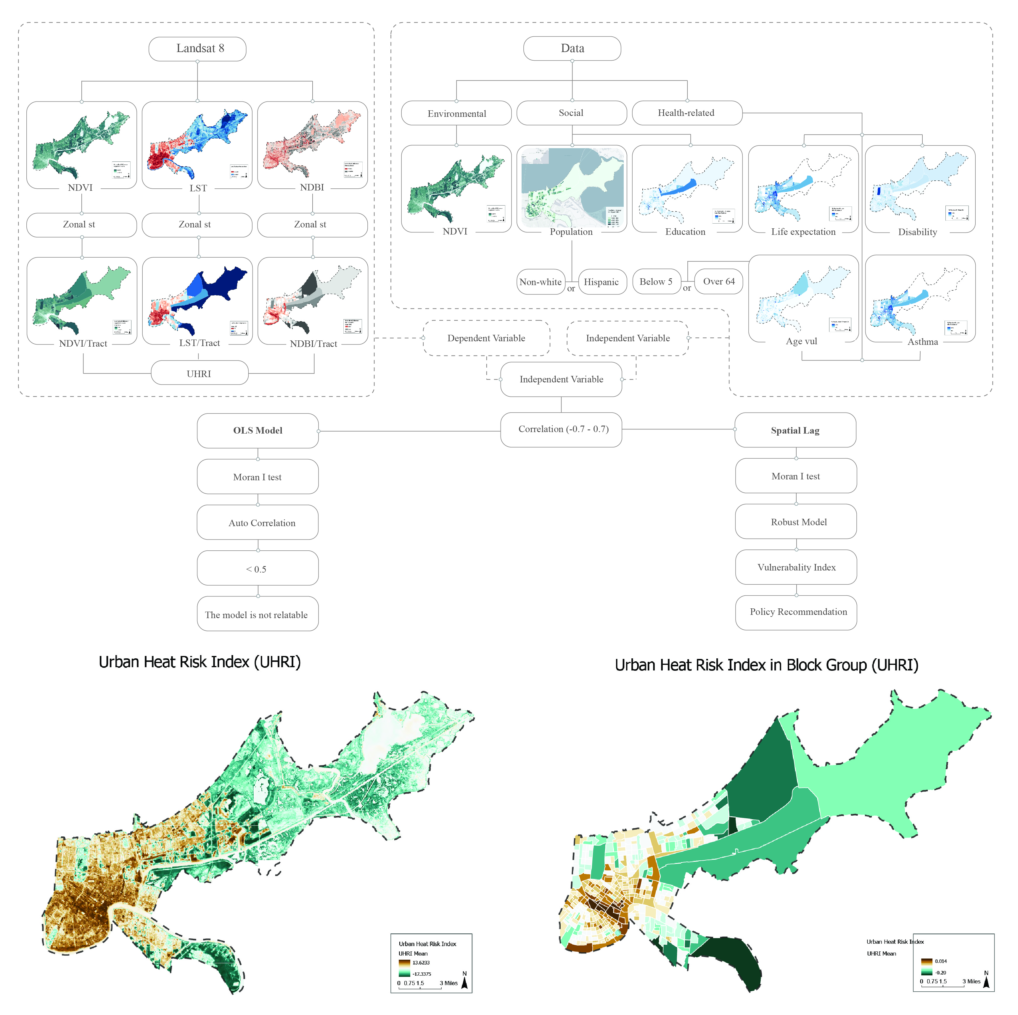
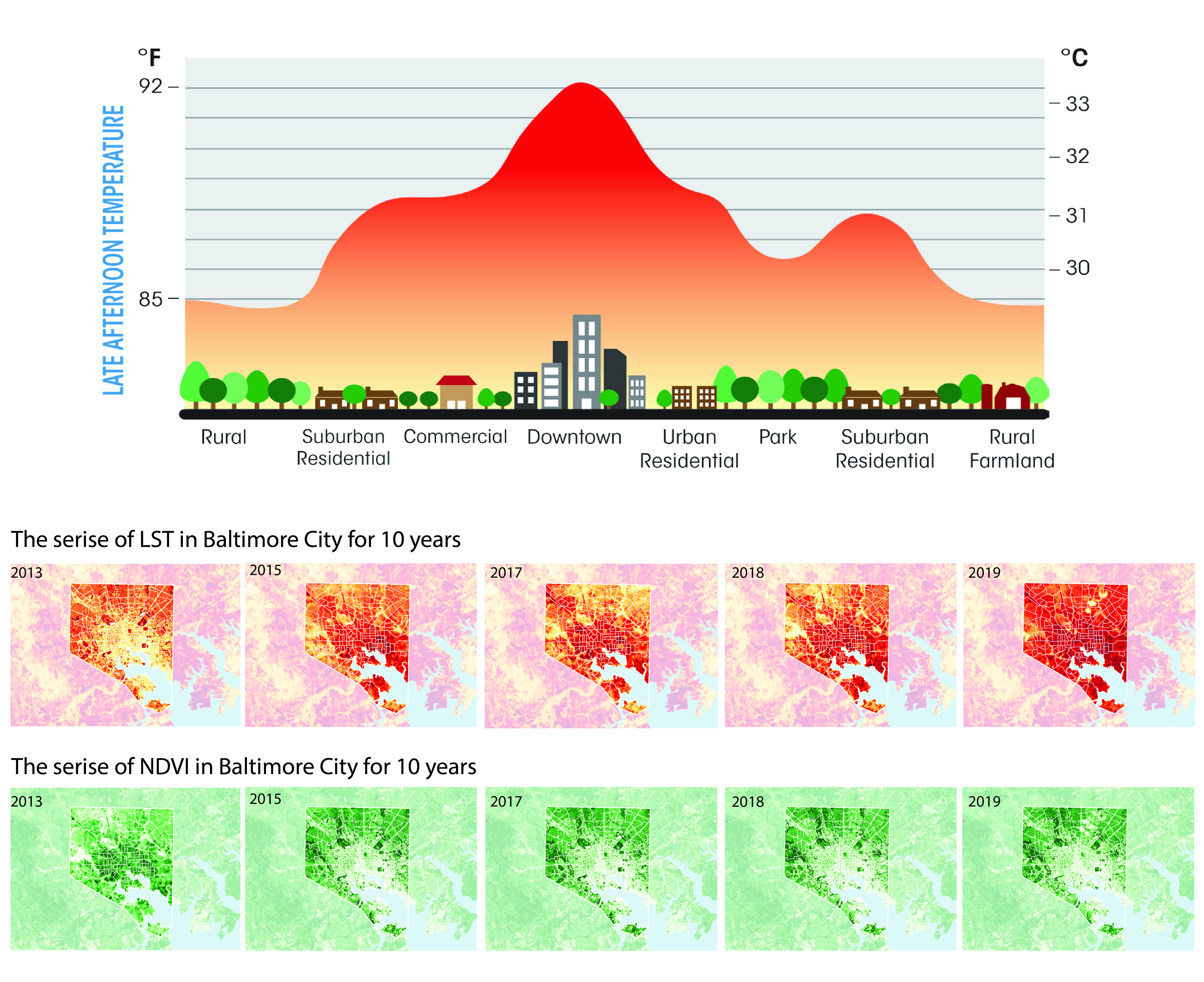
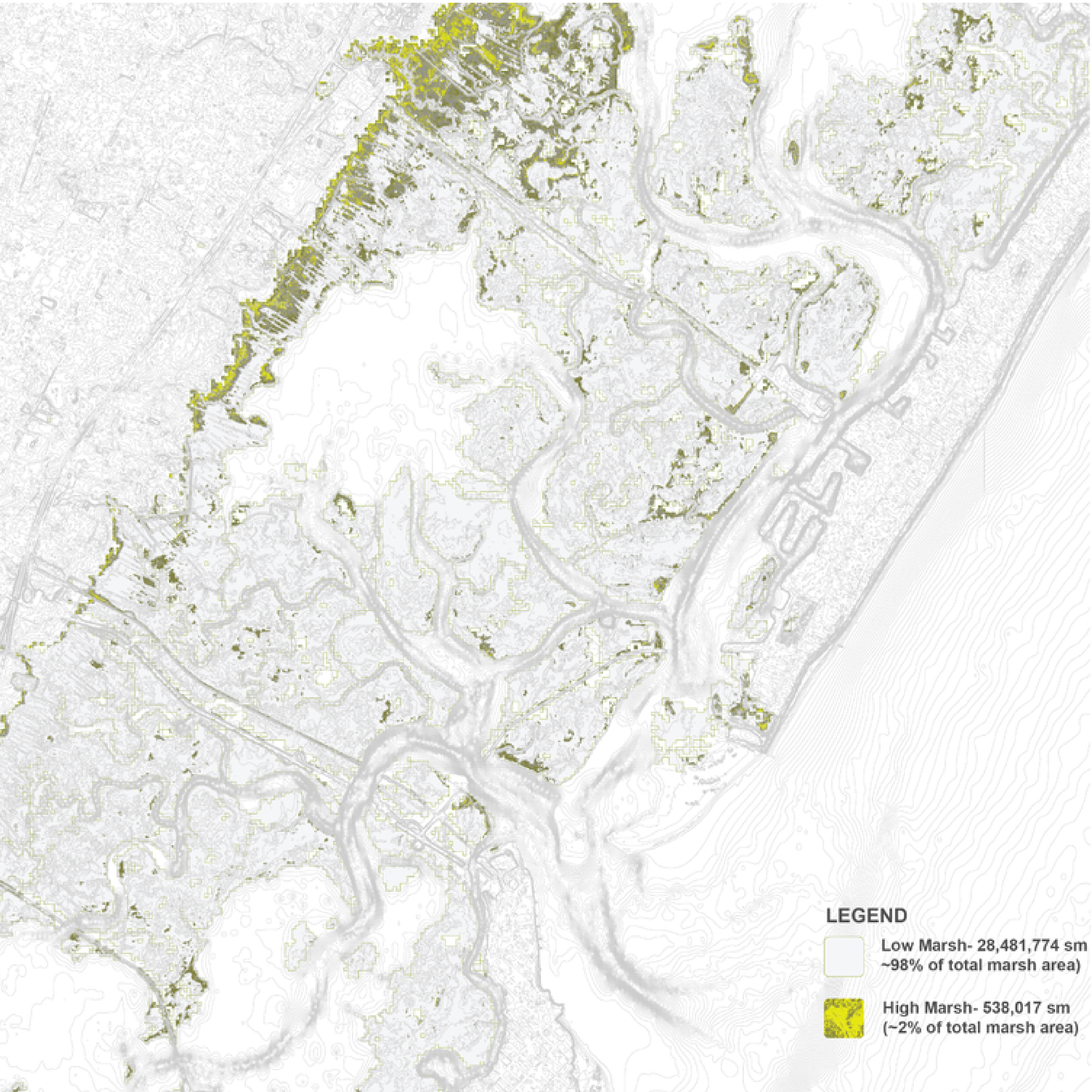
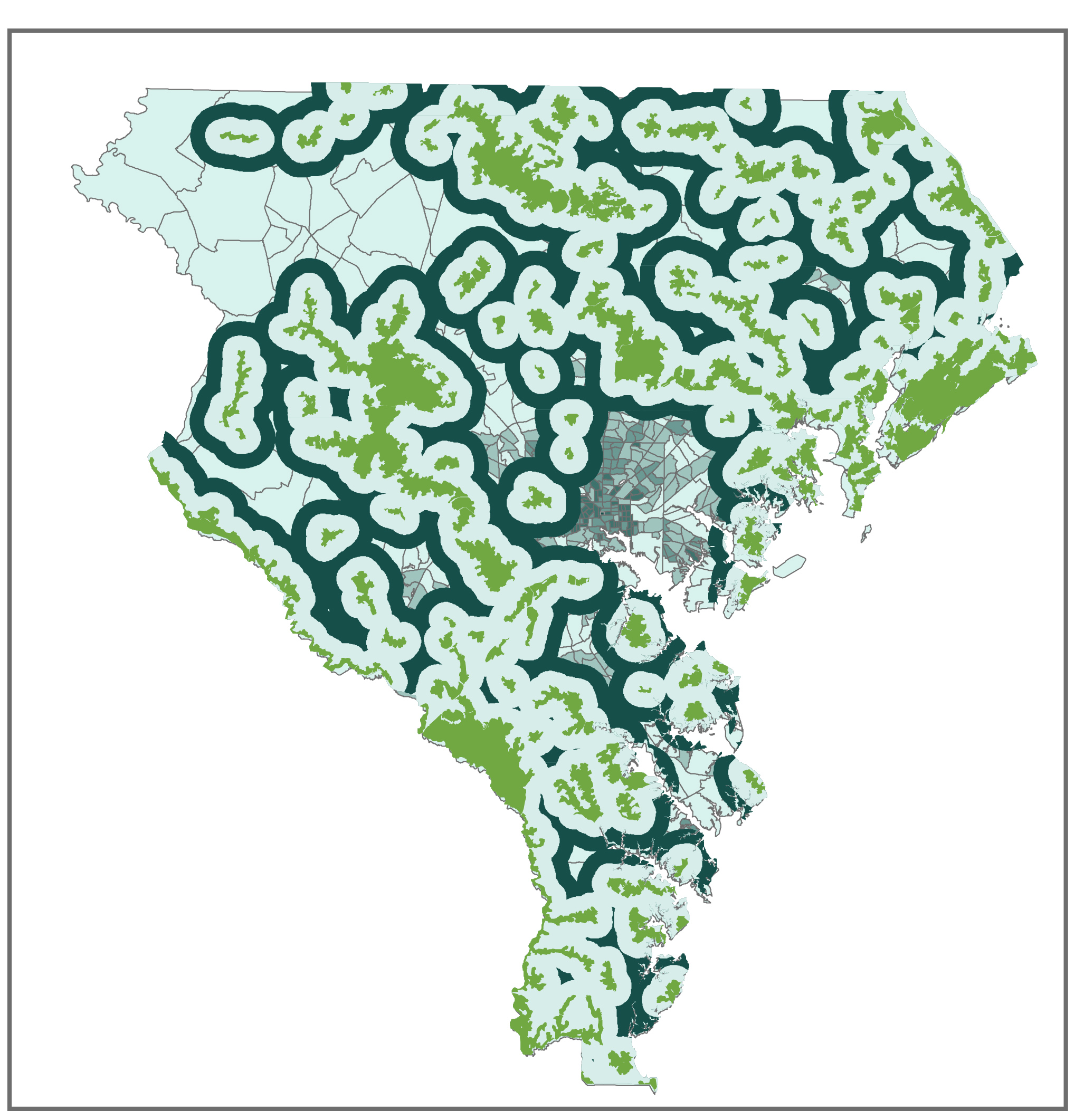
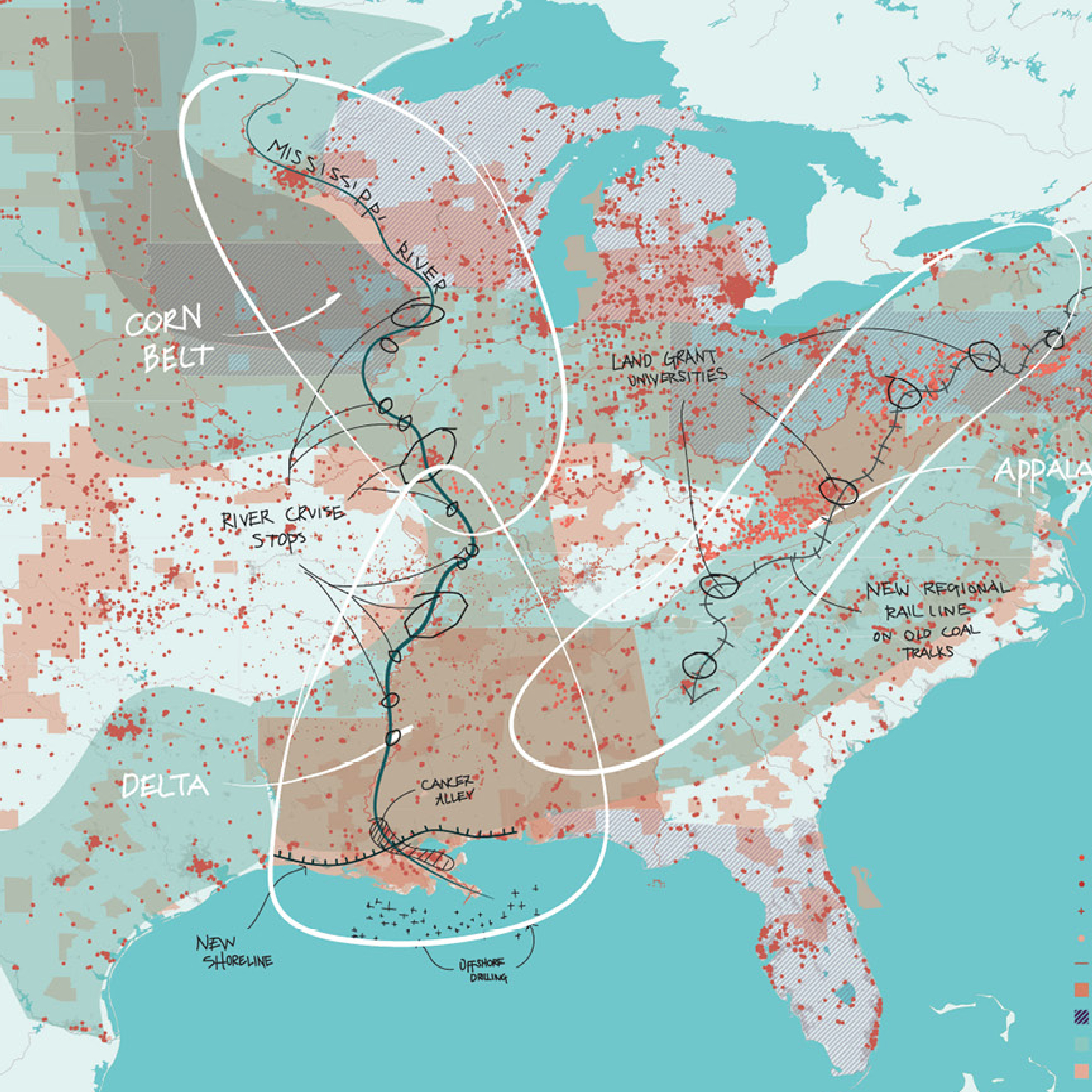
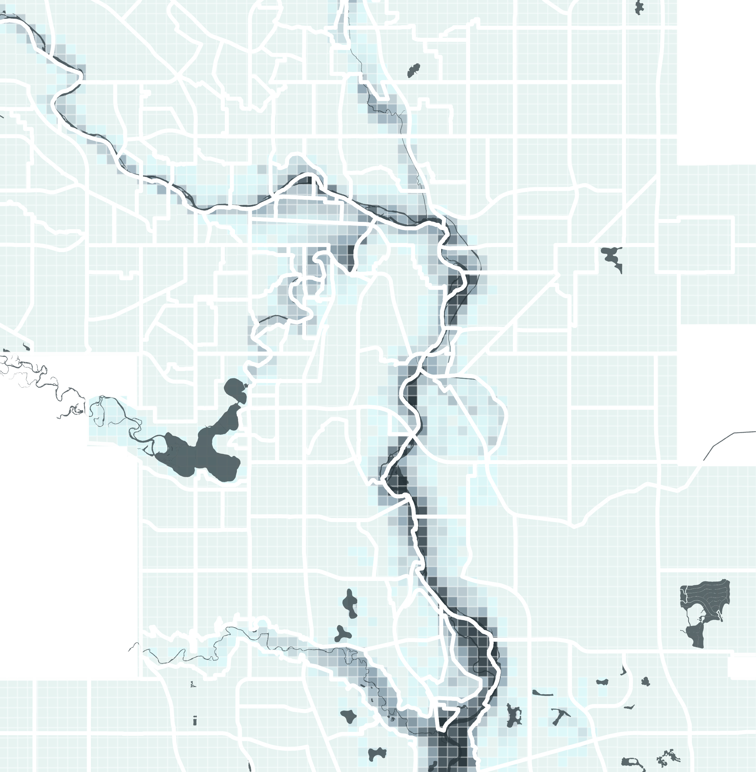
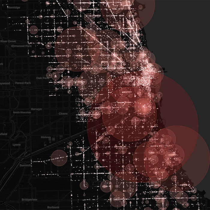
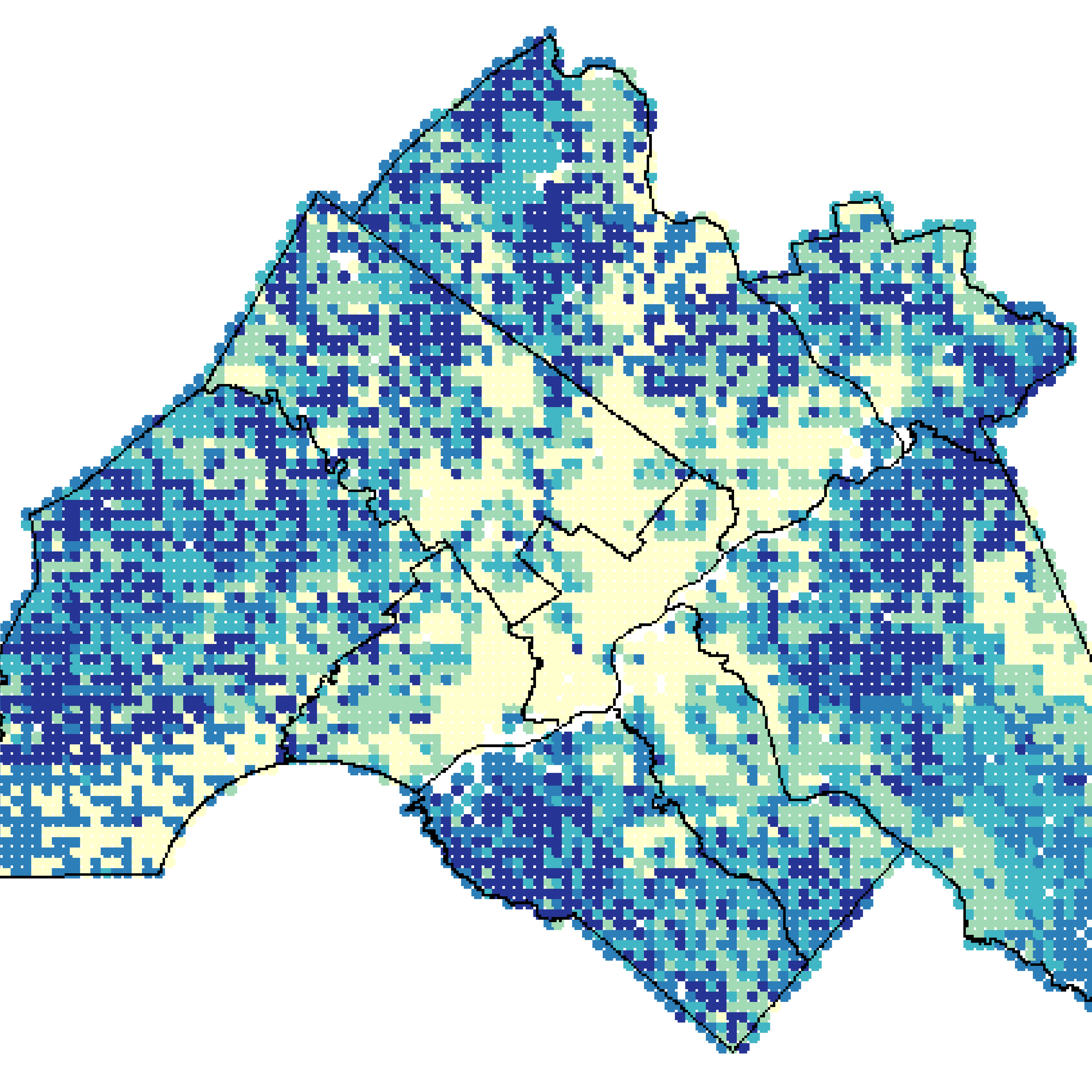
As a research professional with experience at the Environmental Modeling Lab at UPenn and in the private sector, I specialize in integrating spatial data, machine learning, and GIS to analyze human, urban, and natural systems under extreme climate events.
Over the past three years, I have conducted advanced statistical modeling in R to simulate climate vulnerability, leading regional climate action plans, and advanced environmental justice studies.
My current work involves using spatial data and machine learning to understand urban resilience and health challenges in the face of global change, including heat extremes and pandemics.
Mission
My expertise lies in integrating machine learning (Geo-AI), remote sensing and GIS techniques to explore the complex relationships between human, urban and natural systems under climate change, which aims to provide both scientific and practical frameworks for designing more resilient and sustainable communities.
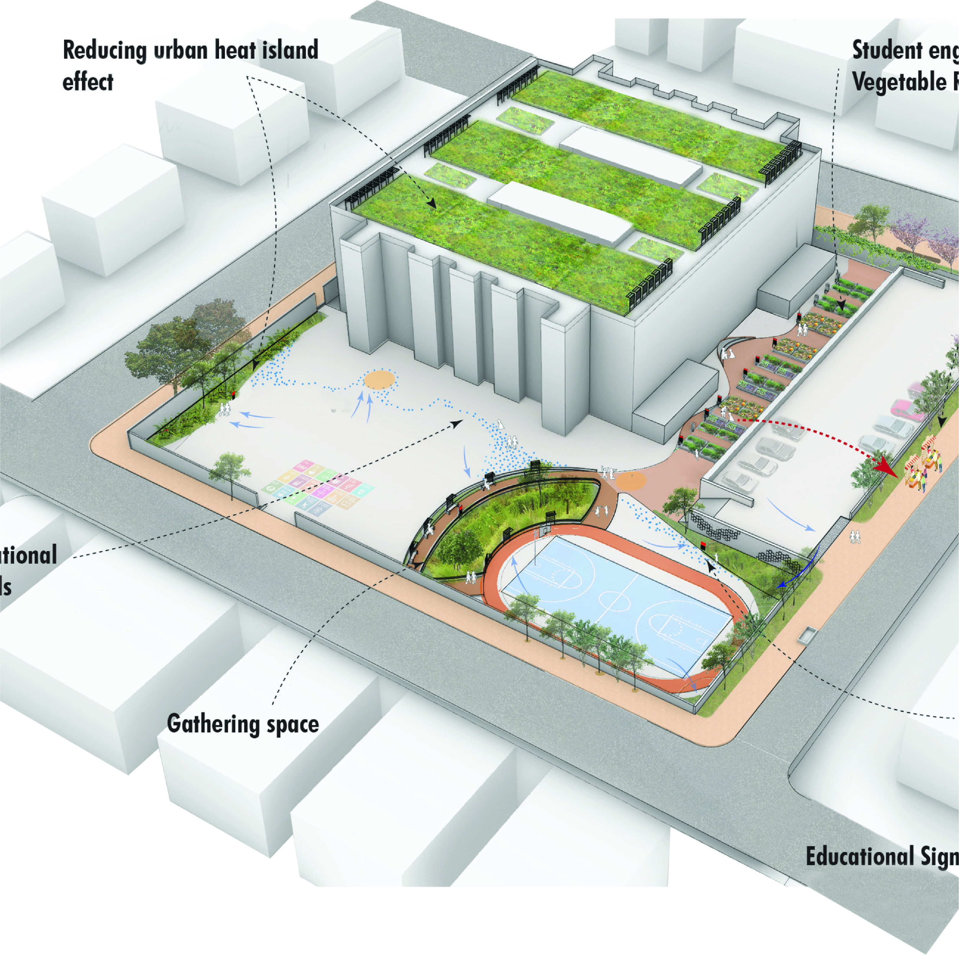
My goal is to promote urban climate equity through urban planning.